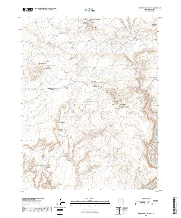
2023 Map of The Windows Section
USGS Topo · Published 2023About this map
Arches National Park defines this landscape of extraordinary geological formations in Grand County, Utah. The map focuses on the dense concentration of natural spans within The Windows Section, where primary park infrastructure like the Main Park Road and Windows Road provides access to world-famous features. High-detail topography reveals the complex drainage patterns of Salt Valley Wash and the winding course of the Colorado River as it passes Mat Martin Point near the southeastern corner.
Find a feature on this map
49 named features on this map. Tap any name to fly to it.
Don’t see what you’re looking for? This feature index may not catch every label — zoom into the map to look around manually.
Map Details
Editions of this 2023 The Windows Section Map
This is the sole edition of this map. No revisions or reprints were ever made.
Other maps of this area

1885 · La Sal
USGS Topo · 1:250,000

1952 · Moab 4 NW
USGS Topo · 1:24,000

1952 · Moab 4 SW
USGS Topo · 1:24,000

1954 · Mt. Waas 3 NW
USGS Topo · 1:24,000

1954 · Mt. Waas 3 SW
USGS Topo · 1:24,000

1954 · Castle Valley
USGS Topo · 1:62,500

1956 · Moab
USGS Topo · 1:250,000

1958 · Thompson
USGS Topo · 1:62,500

1958 · Cisco
USGS Topo · 1:62,500

1959 · Moab
USGS Topo · 1:250,000