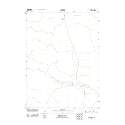
2011 Map of Thedford SE
USGS Topo · Published 2011About this map
The Dismal River carves a winding path through the heart of Thomas County, defining the hydrology and landscape of this Nebraska Sandhills region. This 2011 survey illustrates the sparse infrastructure characteristic of the area, where the river serves as the primary geographical anchor. Human presence is marked by isolated landmarks such as Warner Bridge and the Ewoldt Landing Strip, which provide essential access in a territory dominated by expansive natural drainage patterns. The transport network is anchored by Highway 83 and its predecessor, Old Hwy 83, showing the subtle shift in regional connectivity over time. The map provides a precise look at the river's numerous tight oxbows and the surrounding topography, which remains largely undeveloped.
Find a feature on this map
5 named features on this map. Tap any name to fly to it.
Don’t see what you’re looking for? This feature index may not catch every label — zoom into the map to look around manually.
Map Details
Editions of this 2011 Thedford SE Map
This is the sole edition of this map. No revisions or reprints were ever made.
Other maps of this area

1948 · Thedford
USGS Topo · 1:62,500

1948 · Halsey
USGS Topo · 1:62,500

1949 · Cody Lake
USGS Topo · 1:62,500

1950 · Thedford
USGS Topo · 1:62,500

1950 · Halsey
USGS Topo · 1:62,500

1951 · Cody Lake
USGS Topo · 1:62,500

1951 · Hoagland
USGS Topo · 1:62,500

1954 · North Platte
USGS Topo · 1:250,000

1956 · North Platte
USGS Topo · 1:250,000

1957 · North Platte
USGS Topo · 1:250,000