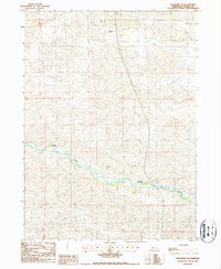
1986 Map of Thedford SE
USGS Topo · Published 1987About this map
The Dismal River carves a narrow, winding corridor through the heart of the Sandhills in this 1980s record of Thomas County. The landscape is dominated by the dense, undulating patterns of stabilizing dunes, where human presence is sparse and primarily limited to the occasional remote landmark like the Ewoldt Landing Strip. The contrast between the lush river valley and the arid, rolling topography above it defines the character of this region, providing a detailed look at the hydrology of one of Nebraska's most unique prairie ecosystems before modern changes. For those studying the geography of the central state, this map preserves the specific cattle-country infrastructure and water-access points of the late twentieth century.
Find a feature on this map
3 named features on this map. Tap any name to fly to it.
Don’t see what you’re looking for? This feature index may not catch every label — zoom into the map to look around manually.
Map Details
Editions of this 1986 Thedford SE Map
This is the sole edition of this map. No revisions or reprints were ever made.
Other maps of this area

1948 · Thedford
USGS Topo · 1:62,500

1948 · Halsey
USGS Topo · 1:62,500

1949 · Cody Lake
USGS Topo · 1:62,500

1950 · Thedford
USGS Topo · 1:62,500

1950 · Halsey
USGS Topo · 1:62,500

1951 · Cody Lake
USGS Topo · 1:62,500

1951 · Hoagland
USGS Topo · 1:62,500

1954 · North Platte
USGS Topo · 1:250,000

1956 · North Platte
USGS Topo · 1:250,000

1957 · North Platte
USGS Topo · 1:250,000