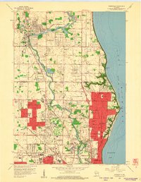
1958 Map of Thiensville
USGS Topo · Published 1960About this map
Milwaukee River meanders southward through the burgeoning northern suburbs of Milwaukee in the late 1950s, defining the landscape for communities like River Hills and Mequon. The map documents a period of rapid suburbanization where large tracts of land are being subdivided into residential blocks, yet significant rural and institutional landmarks remain. Prominent education centers such as Granville High Sch and Maple Dale Sch serve these growing neighborhoods.
Find a feature on this map
63 named features on this map. Tap any name to fly to it.
Don’t see what you’re looking for? This feature index may not catch every label — zoom into the map to look around manually.
Map Details
Editions of this 1958 Thiensville Map
4 editions found
Other maps of this area

1892 · Milwaukee
USGS Topo · 1:62,500

1892 · Waukesha
USGS Topo · 1:62,500

1892 · Port Washington
USGS Topo · 1:62,500

1901 · Milwaukee
USGS Topo · 1:62,500

1901 · Waukesha
USGS Topo · 1:62,500

1904 · West Bend
USGS Topo · 1:62,500

1904 · Port Washington
USGS Topo · 1:62,500

1906 · Waukesha
USGS Topo · 1:62,500

1906 · Milwaukee
USGS Topo · 1:62,500

1954 · Milwaukee
USGS Topo · 1:250,000