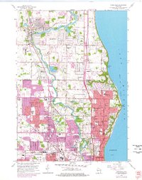
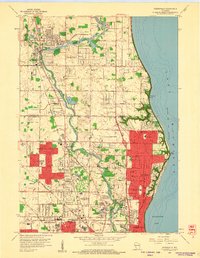
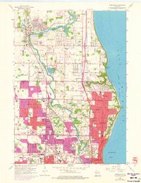
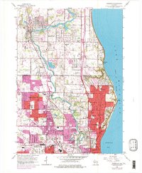
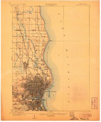
1958 Map of Thiensville
USGS Topo · Published 1977About this map
The Milwaukee River carves a winding path through this mid-century suburban landscape, separating the residential growth of Mequon and Thiensville from the industrial and urban expansion of Milwaukee. The map documents a period of rapid development along the Lake Michigan shoreline, where communities like Fox Point and Bayside meet the bluff. A dense network of local schools, such as Maple Dale Sch and Happyhill Sch, alongside institutional landmarks like Cardinal Stritch College, indicates the postwar population boom. Significant land use for community and military purposes is evident, from the sprawling Graceland Cemetery to several U S Military Reservations. The Chicago and North Western railroad provides a structural spine for the region, while older rural markers like the Mequon Cem and various Gravel Pits persist amidst the new subdivisions.
Find a feature on this map
63 named features on this map. Tap any name to fly to it.
Don’t see what you’re looking for? This feature index may not catch every label — zoom into the map to look around manually.
Map Details
Editions of this 1958 Thiensville Map
4 editions found
Other maps of this area

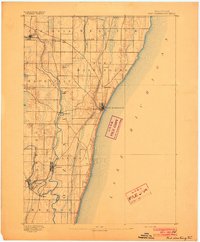
1892 · Milwaukee
USGS Topo · 1:62,500

1892 · Waukesha
USGS Topo · 1:62,500
1892 · Port Washington
USGS Topo · 1:62,500

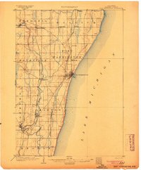
1901 · Milwaukee
USGS Topo · 1:62,500

1901 · Waukesha
USGS Topo · 1:62,500

1904 · West Bend
USGS Topo · 1:62,500
1904 · Port Washington
USGS Topo · 1:62,500

1906 · Waukesha
USGS Topo · 1:62,500
1906 · Milwaukee
USGS Topo · 1:62,500

1954 · Milwaukee
USGS Topo · 1:250,000