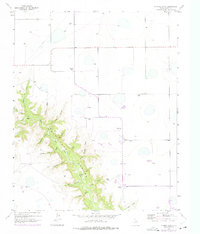
1956 Map of Thomas Ranch
USGS Topo · Published 1975About this map
Palo Duro Canyon dominates the southwestern quadrant of this Randall County landscape, revealing a complex network of erosional features where the Red River has carved into the high plains. The map records a distinct pattern of large-scale land ownership in the mid-1950s, identifying numerous family-named agricultural operations including Smoot Ranch, Thomas Ranch, and Sorelle Ranch. These holdings are concentrated on the flatter tablelands, while the canyon breaks are defined by intricate drainage systems such as Windmill Draw, Chalk Hollow, and Dugout Draw. Evidence of regional utility development is present in the form of a major Pipeline cutting across the northern reaches, while more traditional water sources like Deep Spring and Spring Branch reflect the essential nature of water rights in this semi-arid Texas environment. For the historian, the 1960s and 70s purple revisions indicate subtle changes to the road network and ranch boundaries since the original field check.
Find a feature on this map
30 named features on this map. Tap any name to fly to it.
Don’t see what you’re looking for? This feature index may not catch every label — zoom into the map to look around manually.
Map Details
Editions of this 1956 Thomas Ranch Map
3 editions found
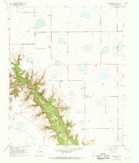
Other maps of this area

1954 · Amarillo
USGS Topo · 1:250,000

1954 · Plainview
USGS Topo · 1:250,000

1956 · Fortress Cliff
USGS Topo · 1:24,000

1956 · Amarillo East
USGS Topo · 1:24,000

1956 · Washburn
USGS Topo · 1:24,000

1956 · Thomas Ranch
USGS Topo · 1:24,000

1956 · Pullman
USGS Topo · 1:24,000

1958 · Amarillo
USGS Topo · 1:250,000

1958 · Plainview
USGS Topo · 1:250,000

1960 · Canyon
USGS Topo · 1:62,500