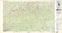
1981 Map of Thomaston
USGS Topo · Published 1982About this map
Pine Mountain and Oak Mountain dominate this Central Georgia landscape, forming a distinctive topographical corridor through Upson, Talbot, and Harris counties. The early 1980s terrain is marked by the sprawling Franklin D Roosevelt State Park and the world-renowned Callaway Gardens near the western edge. Regional transportation is defined by a dense network of state routes, including Georgia 190 tracing the ridgelines, and major rail lines like the Central of Georgia and Seaboard Coast Line.
Find a feature on this map
145 named features on this map. Tap any name to fly to it.
Don’t see what you’re looking for? This feature index may not catch every label — zoom into the map to look around manually.
Map Details
Editions of this 1981 Thomaston Map
This is the sole edition of this map. No revisions or reprints were ever made.
Other maps of this area

1899 · Wedowee
USGS Topo · 1:125,000

1902 · Wedowee
USGS Topo · 1:125,000

1907 · Talbotton
USGS Topo · 1:125,000

1907 · Opelika
USGS Topo · 1:125,000

1908 · Columbus
USGS Topo · 1:62,500

1909 · Opelika
USGS Topo · 1:125,000

1914 · Seale
USGS Topo · 1:62,500

1929 · Columbus
USGS Topo · 1:48,000

1934 · Warm Springs
USGS Topo · 1:62,500

1935 · Thomaston
USGS Topo · 1:48,000