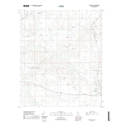
2020 Map of Thomaston West
USGS Topo · Published 2020About this map
Thomaston serves as the primary hub in this corner of Marengo County, where the local road network converges near the intersection of AL Highway 28 and AL Highway 25. The landscape is characterized by a dense network of watercourses, most notably the meandering Chickasaw Bogue, which is fed by numerous tributaries such as Little Dry Creek and Caney Branch. Smaller settlements like Dayton, Hugo, and the evocatively named Half Chance are scattered across the terrain, often identified by proximity to rural crossroads.
Find a feature on this map
61 named features on this map. Tap any name to fly to it.
Don’t see what you’re looking for? This feature index may not catch every label — zoom into the map to look around manually.
Map Details
Editions of this 2020 Thomaston West Map
This is the sole edition of this map. No revisions or reprints were ever made.
Other maps of this area

1953 · Montgomery
USGS Topo · 1:250,000

1956 · Montgomery
USGS Topo · 1:250,000

1957 · Montgomery
USGS Topo · 1:250,000

1968 · Thomaston East
USGS Topo · 1:24,000

1968 · Uniontown West
USGS Topo · 1:24,000

1968 · Thomaston West
USGS Topo · 1:24,000

1968 · Gallion
USGS Topo · 1:24,000

1970 · Old Spring Hill
USGS Topo · 1:24,000

1970 · Linden
USGS Topo · 1:24,000
1978 · Flatwood
USGS Topo · 1:24,000