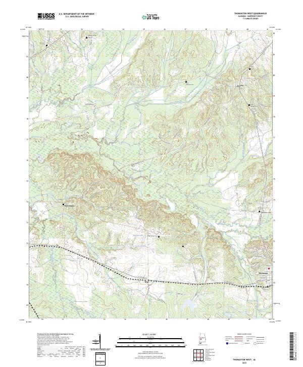
2024 Map of Thomaston West
USGS Topo · Published 2024About this map
The lowlands of eastern Marengo County define this landscape, where the Chickasaw Bogue and its many tributaries, such as Powell Creek and Dry Creek, carve through the terrain. The settlement pattern is characterized by small rural communities and named crossroads, including the interestingly named Half Chance and Hugo. For family historians, the sheet is exceptionally dense with burial sites, preserving the locations of the Quinney Family Cem, Saint Mathews Cem, and Cades Chapel Cem, among others. In the northeastern corner, the town of Dayton sits near the headwaters of Dayton Branch, while Thomaston occupies the eastern edge. The map captures the persistence of traditional land divisions, showing the grid of section lines and range boundaries that have organized this part of the Alabama Black Belt for generations, even as modern routes like AL Highway 28 and AL Highway 25 now connect these historic centers.
Find a feature on this map
67 named features on this map. Tap any name to fly to it.
Don’t see what you’re looking for? This feature index may not catch every label — zoom into the map to look around manually.
Map Details
Editions of this 2024 Thomaston West Map
This is the sole edition of this map. No revisions or reprints were ever made.
Other maps of this area

1953 · Montgomery
USGS Topo · 1:250,000

1956 · Montgomery
USGS Topo · 1:250,000

1957 · Montgomery
USGS Topo · 1:250,000

1968 · Thomaston East
USGS Topo · 1:24,000

1968 · Uniontown West
USGS Topo · 1:24,000

1968 · Thomaston West
USGS Topo · 1:24,000

1968 · Gallion
USGS Topo · 1:24,000

1970 · Old Spring Hill
USGS Topo · 1:24,000

1970 · Linden
USGS Topo · 1:24,000
1978 · Flatwood
USGS Topo · 1:24,000