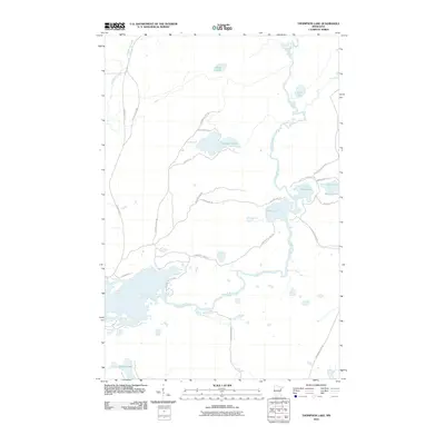
2010 Map of Thompson Lake
USGS Topo · Published 2010About this map
The Cloquet River meanders through this portion of Saint Louis County, defining a landscape of interconnected waterways and specialized residential access. In the early 21st century, the area around Thompson Lake and Alden Lake shows a dense network of local roads such as Huckleberry Ln and Needle Ln, suggesting a transition toward seasonal and permanent waterfront living. Significant historical transportation corridors like the Vermilion Trl and Old Vermilion Trl flank the western and southern reaches of the quadrangle, reflecting the long-standing importance of these routes in northeastern Minnesota. The presence of smaller bodies of water like Little Alden Lake and Spring Lake emphasizes the glacial topography of the region, where the river system and isolated basins like Mouse Lake create a distinct aquatic geography.
Find a feature on this map
27 named features on this map. Tap any name to fly to it.
Don’t see what you’re looking for? This feature index may not catch every label — zoom into the map to look around manually.
Map Details
Editions of this 2010 Thompson Lake Map
This is the sole edition of this map. No revisions or reprints were ever made.
Other maps of this area

1895 · Duluth
USGS Topo · 1:62,500

1953 · French River
USGS Topo · 1:24,000

1953 · Arnold
USGS Topo · 1:24,000

1953 · Boulder Lake Reservoir
USGS Topo · 1:24,000

1953 · Fredenberg
USGS Topo · 1:24,000

1953 · Duluth
USGS Topo · 1:62,500

1953 · Ashland
USGS Topo · 1:250,000

1953 · Duluth
USGS Topo · 1:250,000

1954 · Barrs Lake
USGS Topo · 1:24,000

1954 · Thompson Lake
USGS Topo · 1:24,000
Featured Places
- Normanna Township, MN
- North Star Township, MN
- Gnesen Township, MN
- Marion Lake, MN
- Saint Louis County, MN