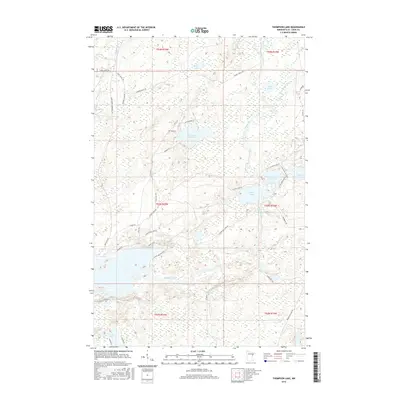
2016 Map of Thompson Lake
USGS Topo · Published 2016About this map
The Cloquet River winds through this heavily forested and wetland-rich landscape in Saint Louis County, defining the drainage patterns for numerous interior lakes. Named water bodies like Thompson Lake, Alden Lake, and Little Alden Lake are connected by a network of local roads and truck trails, suggesting a region focused on timber management and seasonal recreation. The mapping of Carol Truck Trl and Cannon Ball Lake Rd reveals the logistical infrastructure used to navigate the low-lying terrain between Humphrey Cr and Boulder Cr.
Find a feature on this map
44 named features on this map. Tap any name to fly to it.
Don’t see what you’re looking for? This feature index may not catch every label — zoom into the map to look around manually.
Map Details
Editions of this 2016 Thompson Lake Map
This is the sole edition of this map. No revisions or reprints were ever made.
Other maps of this area

1895 · Duluth
USGS Topo · 1:62,500

1953 · French River
USGS Topo · 1:24,000

1953 · Arnold
USGS Topo · 1:24,000

1953 · Boulder Lake Reservoir
USGS Topo · 1:24,000

1953 · Fredenberg
USGS Topo · 1:24,000

1953 · Duluth
USGS Topo · 1:62,500

1953 · Ashland
USGS Topo · 1:250,000

1953 · Duluth
USGS Topo · 1:250,000

1954 · Barrs Lake
USGS Topo · 1:24,000

1954 · Thompson Lake
USGS Topo · 1:24,000
Featured Places
- Normanna Township, MN
- North Star Township, MN
- Gnesen Township, MN
- Marion Lake, MN
- Saint Louis County, MN