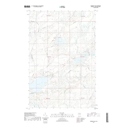
2019 Map of Thompson Lake
USGS Topo · Published 2019About this map
The Cloquet River and its tributary, the Little Cloquet River, dominate this landscape in Saint Louis County, winding through a terrain defined by glacial lakes and secondary forest roads. In 2019, the area remains characterized by its dense network of water bodies, including the centrally located Thompson Lake and the larger Alden Lake to the southeast. The transportation network consists primarily of local connectors and historical trails like the Vermilion Trl and the Rudy Perpich Memorial Dr, reflecting the rural and recreational nature of this northern Minnesota region. Small clusters of residential development are visible along the shorelines of Little Alden Lake and Jacobs Lake, while roads like Cannon Ball Lake Rd and Timberlake Trl provide access to the more isolated tracts of woodland and marsh near Lost Lake and Mouse Lake.
Find a feature on this map
45 named features on this map. Tap any name to fly to it.
Don’t see what you’re looking for? This feature index may not catch every label — zoom into the map to look around manually.
Map Details
Editions of this 2019 Thompson Lake Map
This is the sole edition of this map. No revisions or reprints were ever made.
Other maps of this area

1895 · Duluth
USGS Topo · 1:62,500

1953 · French River
USGS Topo · 1:24,000

1953 · Arnold
USGS Topo · 1:24,000

1953 · Boulder Lake Reservoir
USGS Topo · 1:24,000

1953 · Fredenberg
USGS Topo · 1:24,000

1953 · Duluth
USGS Topo · 1:62,500

1953 · Ashland
USGS Topo · 1:250,000

1953 · Duluth
USGS Topo · 1:250,000

1954 · Barrs Lake
USGS Topo · 1:24,000

1954 · Thompson Lake
USGS Topo · 1:24,000
Featured Places
- Normanna Township, MN
- North Star Township, MN
- Gnesen Township, MN
- Marion Lake, MN
- Saint Louis County, MN