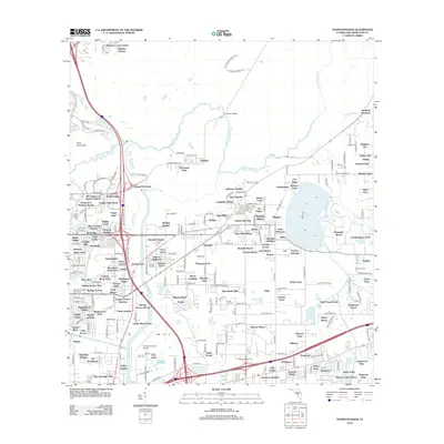
2012 Map of Thonotosassa
USGS Topo · Published 2012About this map
Lake Thonotosassa dominates the eastern landscape of this Hillsborough County survey, its shores surrounded by a dense network of residential developments and agricultural holdings. The Hillsborough River meanders across the northern half of the map, crossed at the Morris Bridge crossing. The region's transition from rural groves to suburban sprawl is evident in the cluster of neighborhoods such as Antioch Acres, Thousand Oaks, and Jefferson Heights.
Find a feature on this map
234 named features on this map. Tap any name to fly to it.
Don’t see what you’re looking for? This feature index may not catch every label — zoom into the map to look around manually.
Map Details
Editions of this 2012 Thonotosassa Map
This is the sole edition of this map. No revisions or reprints were ever made.
Other maps of this area

1921 · Tampa
USGS Topo · 1:62,500

1943 · Thonotosassa
USGS Topo · 1:24,000

1943 · Lutz
USGS Topo · 1:24,000

1944 · Sulphur Springs
USGS Topo · 1:31,680

1944 · Mango
USGS Topo · 1:31,680

1944 · Tampa
USGS Topo · 1:31,680

1944 · Wesley Chapel
USGS Topo · 1:31,680

1944 · Lutz
USGS Topo · 1:31,680

1944 · Thonotosassa
USGS Topo · 1:31,680

1944 · Antioch
USGS Topo · 1:31,680