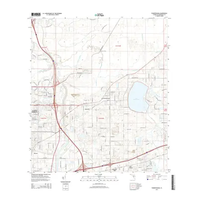
2015 Map of Thonotosassa
USGS Topo · Published 2015About this map
Lake Thonotosassa dominates the eastern landscape, serving as a primary focal point for the surrounding communities in this part of Hillsborough County. The Hillsborough River meanders across the northern and western sections, joined by tributaries such as Trout Creek and Cow House Creek. This 2015 survey illustrates a mix of well-established residential areas like Temple Terrace and more localized settlements including Thonotosassa, Clarkwild, and Harney.
Find a feature on this map
141 named features on this map. Tap any name to fly to it.
Don’t see what you’re looking for? This feature index may not catch every label — zoom into the map to look around manually.
Map Details
Editions of this 2015 Thonotosassa Map
This is the sole edition of this map. No revisions or reprints were ever made.
Other maps of this area

1921 · Tampa
USGS Topo · 1:62,500

1943 · Thonotosassa
USGS Topo · 1:24,000

1943 · Lutz
USGS Topo · 1:24,000

1944 · Sulphur Springs
USGS Topo · 1:31,680

1944 · Mango
USGS Topo · 1:31,680

1944 · Tampa
USGS Topo · 1:31,680

1944 · Wesley Chapel
USGS Topo · 1:31,680

1944 · Lutz
USGS Topo · 1:31,680

1944 · Thonotosassa
USGS Topo · 1:31,680

1944 · Antioch
USGS Topo · 1:31,680