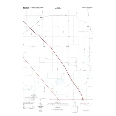
2013 Map of Thorntown
USGS Topo · Published 2013About this map
The town of Thorntown serves as the primary hub in this section of Boone County, situated along the banks of Sugar Cr and Prairie Cr. The landscape is defined by a dense network of county roads and drainage systems essential to Indiana's agricultural heartland, including Sims Rogers Ditch and Harr Wills Ditch. Smaller rural settlements like Manson, Antioch, and Reagan are connected by a grid of numbered roads, reflecting the organized settlement patterns of the region.
Find a feature on this map
88 named features on this map. Tap any name to fly to it.
Don’t see what you’re looking for? This feature index may not catch every label — zoom into the map to look around manually.
Map Details
Editions of this 2013 Thorntown Map
This is the sole edition of this map. No revisions or reprints were ever made.
Other maps of this area

1953 · Lebanon
USGS Topo · 1:24,000

1953 · Danville
USGS Topo · 1:250,000

1955 · Danville
USGS Topo · 1:250,000

1956 · Danville
USGS Topo · 1:250,000

1961 · Michigantown
USGS Topo · 1:24,000

1961 · Mulberry
USGS Topo · 1:24,000

1961 · Mechanicsburg
USGS Topo · 1:24,000

1961 · Frankfort
USGS Topo · 1:24,000
1961 · Hazelrigg
USGS Topo · 1:24,000
1961 · Shannondale
USGS Topo · 1:24,000