
1909 Map of Thornville
USGS Topo · Published 1938About this map
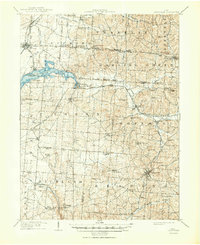
Buckeye Lake dominates the northwest quadrant of this survey, bordered by the communities of Thornport and Shell Beach. The map details a landscape transitioning from the low-lying lake margins to the prominent heights of Buzzard Glory Knob and the rugged contours around Devils Den. Early transportation corridors are a primary focus, featuring the prominent National Road and a complex rail network including the Ohio Central R R and the Baltimore and Ohio R R.
Find a feature on this map
74 named features on this map. Tap any name to fly to it.
Don’t see what you’re looking for? This feature index may not catch every label — zoom into the map to look around manually.
Map Details
Editions of this 1909 Thornville Map
2 editions found
Other maps of this area

1907 · Logan
USGS Topo · 1:62,500

1907 · Lancaster
USGS Topo · 1:62,500

1907 · Thurston
USGS Topo · 1:62,500

1908 · Granville
USGS Topo · 1:62,500

1909 · Newark
USGS Topo · 1:62,500

1909 · Lancaster
USGS Topo · 1:62,500

1909 · Logan
USGS Topo · 1:62,500

1909 · Thurston
USGS Topo · 1:62,500

1910 · Frazeysburg
USGS Topo · 1:62,500

1910 · Zanesville
USGS Topo · 1:62,500