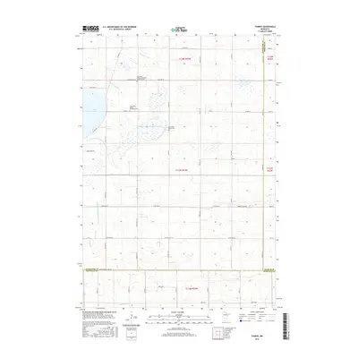
2016 Map of Thorpe
USGS Topo · Published 2016About this map
The S Fork Crow River and Buffalo Cr define the hydrological character of this landscape at the intersection of Kandiyohi, Meeker, and Renville Counties. This region is marked by an extensive network of drainage infrastructure, including County Ditch Number Fiftytwo, County Ditch Number Twentyfour A, and County Ditch Number Fiftyone, reflecting a highly managed prairie landscape designed for agriculture. For genealogists, the map is particularly valuable for identifying historic interment sites such as the Early Lake Lillian Community Burial Ground, located north of the town of Lake Lillian. The small settlement of Thorpe appears in the eastern portion of the quadrangle, while the local religious history is anchored by the Lake Lillian United Methodist Cem and the Lake Lillian Baptist Cem. Several smaller water bodies, including Emma Lake and Dog Lake, dot the townships of T118N and T117N.
Find a feature on this map
40 named features on this map. Tap any name to fly to it.
Don’t see what you’re looking for? This feature index may not catch every label — zoom into the map to look around manually.
Map Details
Editions of this 2016 Thorpe Map
This is the sole edition of this map. No revisions or reprints were ever made.
Other maps of this area

1953 · New Ulm
USGS Topo · 1:250,000

1953 · Saint Cloud
USGS Topo · 1:250,000

1956 · Atwater
USGS Topo · 1:62,500

1957 · Saint Cloud
USGS Topo · 1:250,000

1957 · New Ulm
USGS Topo · 1:250,000

1957 · Olivia
USGS Topo · 1:62,500

1958 · New Ulm
USGS Topo · 1:250,000

1958 · Saint Cloud
USGS Topo · 1:250,000

1967 · New Ulm
USGS Topo · 1:250,000

1967 · Churchill
USGS Topo · 1:24,000