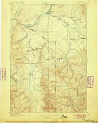
1895 Map of Three Forks
USGS Topo · Published 1906About this map
Virginia City and the territorial-era mining districts anchor this late 19th-century survey of southwest Montana, where the headwaters of the Missouri come together. The confluence of the Jefferson River, Madison River, and Gallatin River near Threeforks creates a natural hub for early settlement and transportation. The Northern Pacific Railroad defines the northern corridor, connecting towns like Manhattan, Logan, and Belgrade to the regional center at Bozeman.
Find a feature on this map
110 named features on this map. Tap any name to fly to it.
Don’t see what you’re looking for? This feature index may not catch every label — zoom into the map to look around manually.
Map Details
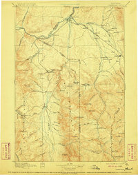
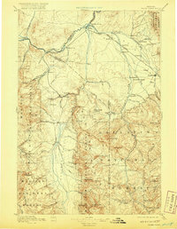
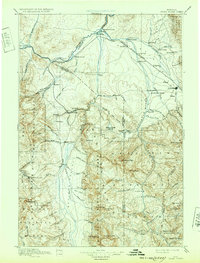
Editions of this 1895 Three Forks Map
5 editions found

Other maps of this area

1885 · Gallatin
USGS Topo · 1:125,000

1885 · Gallatin
USGS Topo · 1:125,000

1886 · Fort Logan
USGS Topo · 1:250,000

1886 · Little Belt Mts.
USGS Topo · 1:250,000

1888 · Three Forks
USGS Topo · 1:250,000

1889 · Helena
USGS Topo · 1:250,000

1891 · Livingston
USGS Topo · 1:250,000

1893 · Helena
USGS Topo · 1:250,000

1893 · Dillon
USGS Topo · 1:250,000

1893 · Livingston
USGS Topo · 1:250,000