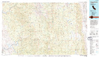
1978 Map of Three Rivers
USGS Topo · Published 1994About this map
The Sierra Nevada range dominates this 1978 landscape, where the high peaks of the Great Western Divide separate the deep Kern Canyon from the western foothills. The map documents the intricate water systems essential to the region, showing the various forks of the Kaweah River and Tule River feeding into reservoirs like Lake Kaweah and Lake Success. Small mountain communities and seasonal retreats such as Mineral King, Silver City, and Camp Nelson are visible, alongside the larger hub of Porterville and the Tule River Indian Reservation. In the east, the terrain drops sharply into the Owens Valley, meeting the Owens River and the edges of Owens Lake. This edition reflects a period of established conservation and recreational use, with boundaries clearly defined for Sequoia National Park, the John Muir Wilderness, and Mountain Home State Forest.
Find a feature on this map
55 named features on this map. Tap any name to fly to it.
Don’t see what you’re looking for? This feature index may not catch every label — zoom into the map to look around manually.
Map Details
Editions of this 1978 Three Rivers Map
2 editions found
Other maps of this area

1903 · Tehipite
USGS Topo · 1:125,000

1904 · Kaweah
USGS Topo · 1:125,000

1905 · Tehipite
USGS Topo · 1:125,000

1905 · Olancha
USGS Topo · 1:125,000

1905 · Fairview
USGS Topo · 1:24,000

1906 · Kernville
USGS Topo · 1:125,000

1907 · Olancha
USGS Topo · 1:125,000

1907 · Mt. Whitney
USGS Topo · 1:125,000

1908 · Kernville
USGS Topo · 1:125,000

1908 · Ballarat
USGS Topo · 1:250,000