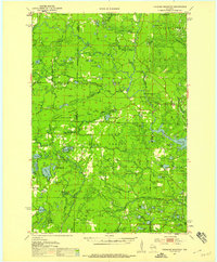
1951 Map of Thunder Mountain
USGS Topo · Published 1958About this map
The Nicolet National Forest dominates this mid-century landscape where the border of Forest, Marinette, and Oconto Counties meet. This 1951 survey reveals a heavily forested region managed for conservation and recreation, evidenced by the presence of both the McCaslin Lookout Tower and the Thunder Mountain Lookout Tower perched on their respective peaks. The hydrology of the area is particularly complex, defined by the winding course of the Peshtigo River as it passes through Wilson Rapids and Roaring Rapids. Cultural landmarks are sparse but significant, including the Shady Nook Sch and a Fish Hatchery near the southern boundary. The map captures an era of post-war forestry and public land development, preserved in the network of logging trails and small water bodies like McCaslin Lake and the Three Little Lakes.
Find a feature on this map
86 named features on this map. Tap any name to fly to it.
Don’t see what you’re looking for? This feature index may not catch every label — zoom into the map to look around manually.
Map Details
Editions of this 1951 Thunder Mountain Map
3 editions found

Other maps of this area

1939 · Dunbar
USGS Topo · 1:48,000

1939 · Goodman
USGS Topo · 1:48,000

1939 · Laona
USGS Topo · 1:48,000

1940 · Thunder Mtn.
USGS Topo · 1:48,000

1940 · Athelstane
USGS Topo · 1:48,000

1941 · Dunbar
USGS Topo · 1:48,000

1941 · Coleman
USGS Topo · 1:48,000

1942 · Athelstane
USGS Topo · 1:48,000

1942 · Coleman
USGS Topo · 1:48,000

1942 · Breed
USGS Topo · 1:48,000