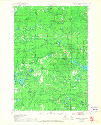
1951 Map of Thunder Mountain
USGS Topo · Published 1967About this map
Nicolet National Forest dominates the landscape of this 1950s survey, showing a heavily timbered and water-rich region at the junction of Marinette, Forest, and Oconto counties. The topography is defined by the prominent heights of McCaslin Mountain and Thunder Mountain, both of which served as critical observation points for fire protection with their respective McCaslin Lookout Tower and Thunder Mountain Lookout Tower.
Find a feature on this map
84 named features on this map. Tap any name to fly to it.
Don’t see what you’re looking for? This feature index may not catch every label — zoom into the map to look around manually.
Map Details
Editions of this 1951 Thunder Mountain Map
3 editions found

Other maps of this area

1939 · Dunbar
USGS Topo · 1:48,000

1939 · Goodman
USGS Topo · 1:48,000

1939 · Laona
USGS Topo · 1:48,000

1940 · Thunder Mtn.
USGS Topo · 1:48,000

1940 · Athelstane
USGS Topo · 1:48,000

1941 · Dunbar
USGS Topo · 1:48,000

1941 · Coleman
USGS Topo · 1:48,000

1942 · Athelstane
USGS Topo · 1:48,000

1942 · Coleman
USGS Topo · 1:48,000

1942 · Breed
USGS Topo · 1:48,000