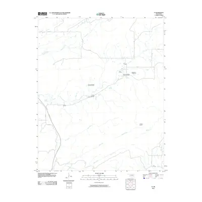
2010 Map of Ti
USGS Topo · Published 2010About this map
Ti Valley serves as a focal point for this Pittsburg County landscape, where the rural character is defined by a network of creeks and small-scale water management. The area is marked by numerous flood control structures, including Brushy Peaceable Creek Site 9 Dam and the Oknoname 121006 Dam. These hydraulic features coordinate with natural drainages like Modisette Creek, Elm Creek, and Hogeye Creek to manage the watershed east of the Indian Nation Tpke.
Find a feature on this map
32 named features on this map. Tap any name to fly to it.
Don’t see what you’re looking for? This feature index may not catch every label — zoom into the map to look around manually.
Map Details
Editions of this 2010 Ti Map
This is the sole edition of this map. No revisions or reprints were ever made.
Other maps of this area

1898 · McAlester
USGS Topo · 1:125,000

1909 · Mc Alester
USGS Topo · 1:125,000

1950 · Mcalester
USGS Topo · 1:250,000

1962 · McAlester
USGS Topo · 1:250,000

1965 · McAlester
USGS Topo · 1:250,000

1967 · Pittsburg
USGS Topo · 1:24,000

1967 · Hartshorne SW
USGS Topo · 1:24,000
1967 · Savanna
USGS Topo · 1:24,000

1967 · Hartshorne
USGS Topo · 1:24,000
1973 · Adel
USGS Topo · 1:24,000