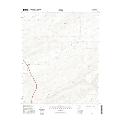
2016 Map of Ti
USGS Topo · Published 2016About this map
Ti and Pine Top sit within a landscape defined by deep ridges and valleys in this modern topographic survey. The area is characterized by significant topographic relief, with Limestone Ridge and New State Mtn overlooking the flat stretches of Ti Valley and McGee Valley. Water management is a visible priority here, evidenced by the series of flood control structures along Elm Cr, including the Brushy Peaceable Creek Site 10 Reservoir and its companion sites.
Find a feature on this map
41 named features on this map. Tap any name to fly to it.
Don’t see what you’re looking for? This feature index may not catch every label — zoom into the map to look around manually.
Map Details
Editions of this 2016 Ti Map
This is the sole edition of this map. No revisions or reprints were ever made.
Other maps of this area

1898 · McAlester
USGS Topo · 1:125,000

1909 · Mc Alester
USGS Topo · 1:125,000

1950 · Mcalester
USGS Topo · 1:250,000

1962 · McAlester
USGS Topo · 1:250,000

1965 · McAlester
USGS Topo · 1:250,000

1967 · Pittsburg
USGS Topo · 1:24,000

1967 · Hartshorne SW
USGS Topo · 1:24,000
1967 · Savanna
USGS Topo · 1:24,000

1967 · Hartshorne
USGS Topo · 1:24,000
1973 · Adel
USGS Topo · 1:24,000