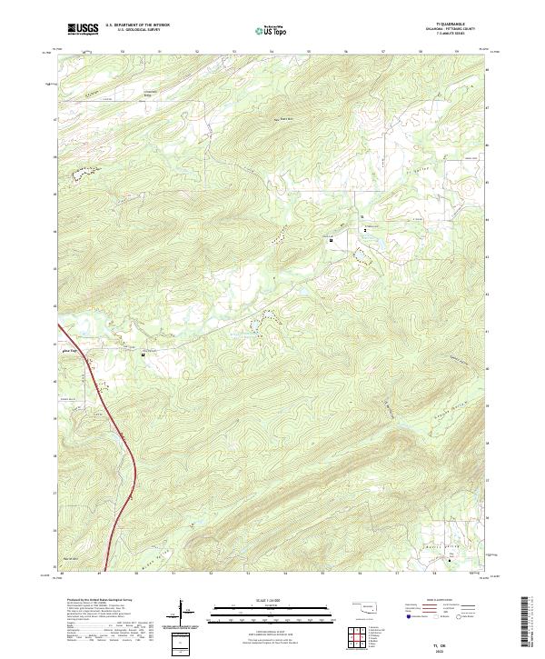
2022 Map of Ti
USGS Topo · Published 2022About this map
Ti and Pine Top anchor this part of Pittsburg County, where the terrain is defined by a series of prominent ridges and deep-set valleys. The landscape is dominated by New State Mtn and Limestone Ridge, which channel the local drainage into creeks like Elm Cr and Modisette Cr. Several small water storage sites, including 121006 Reservoir and the Brushy Peaceable Cr Site 11 Reservoir, point to the region's managed water resources. For those researching local history or genealogy, the distribution of small burial grounds such as Ti Valley Cem, Lewis Cem, and Pine Top Cem provides a clear map of early settlement patterns across the Ti Valley and Burris Valley. The network of country roads, including Ti Valley RD and Burns Loop, follows the natural contours of the land, connecting isolated homesites and agricultural tracts through named hollows like Sawmill Hollow and Hogeye Hollow.
Find a feature on this map
45 named features on this map. Tap any name to fly to it.
Don’t see what you’re looking for? This feature index may not catch every label — zoom into the map to look around manually.
Map Details
Editions of this 2022 Ti Map
This is the sole edition of this map. No revisions or reprints were ever made.
Other maps of this area

1898 · McAlester
USGS Topo · 1:125,000

1909 · Mc Alester
USGS Topo · 1:125,000

1950 · Mcalester
USGS Topo · 1:250,000

1962 · McAlester
USGS Topo · 1:250,000

1965 · McAlester
USGS Topo · 1:250,000

1967 · Pittsburg
USGS Topo · 1:24,000

1967 · Hartshorne SW
USGS Topo · 1:24,000
1967 · Savanna
USGS Topo · 1:24,000

1967 · Hartshorne
USGS Topo · 1:24,000
1973 · Adel
USGS Topo · 1:24,000