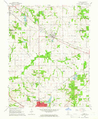
1965 Map of Tilden
USGS Topo · Published 1966About this map
The Illinois coal and rail belt is captured here mid-century, defined by the convergence of the Illinois Central, Gulf Mobile and Ohio, and Missouri Illinois railroads. The industrial character of the landscape is evident through several Oil Wells scattered between the settlements of Tilden and Clarmin. On the southern edge of the sheet, the city of Sparta serves as a significant regional hub, supported by the Sparta Community Airport and its beacon.
Find a feature on this map
27 named features on this map. Tap any name to fly to it.
Don’t see what you’re looking for? This feature index may not catch every label — zoom into the map to look around manually.
Map Details
Editions of this 1965 Tilden Map
2 editions found
Other maps of this area

1910 · Okawville
USGS Topo · 1:62,500

1912 · New Athens
USGS Topo · 1:62,500

1912 · Baldwin
USGS Topo · 1:62,500

1914 · Baldwin
USGS Topo · 1:62,500

1914 · Coulterville
USGS Topo · 1:62,500

1917 · Coulterville
USGS Topo · 1:62,500

1940 · Okawville
USGS Topo · 1:62,500

1942 · Baldwin
USGS Topo · 1:62,500
1954 · New Athens East
USGS Topo · 1:24,000
1954 · New Athens
USGS Topo · 1:62,500