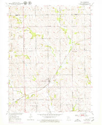
1952 Map of Tina
USGS Topo · Published 1979About this map
Tina serves as the central hub of this Missouri landscape, situated where the Chicago And Quincy And Burlington railroad once cut through the prairie. The surrounding rural countryside is notably dense with localized educational and community landmarks, featuring an array of small institutions such as Oakland Sch, Grace Sch, and North Star Sch. These school sites, along with Macklin Cem and Rock Branch Cem, offer vital touchstones for genealogists tracing family roots in Fairview and Grand River townships.
Find a feature on this map
23 named features on this map. Tap any name to fly to it.
Don’t see what you’re looking for? This feature index may not catch every label — zoom into the map to look around manually.
Map Details
Editions of this 1952 Tina Map
3 editions found
Other maps of this area

1889 · Lexington
USGS Topo · 1:125,000

1890 · Marshall
USGS Topo · 1:125,000

1892 · Marshall
USGS Topo · 1:125,000

1901 · Marshall
USGS Topo · 1:125,000

1924 · Dawn
USGS Topo · 1:62,500

1924 · Hale
USGS Topo · 1:62,500

1950 · Coloma
USGS Topo · 1:24,000

1950 · Hale
USGS Topo · 1:24,000

1951 · Hale
USGS Topo · 1:24,000

1951 · Bosworth
USGS Topo · 1:24,000