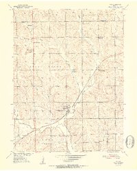
1952 Map of Tina
USGS Topo · Published 1952About this map
Tina sits at the heart of this rural Missouri landscape, serving as a hub for the surrounding township at the start of the 1950s. The settlement is defined by its position along the Chicago Burlington and Quincy railroad, which cuts diagonally across the terrain. This map reveals a community structured around its rural institutions, with a high density of country schools including Pension Sch, North Star Sch, Grace Sch, and the notably labeled West Sch (Abandoned).
Find a feature on this map
28 named features on this map. Tap any name to fly to it.
Don’t see what you’re looking for? This feature index may not catch every label — zoom into the map to look around manually.
Map Details
Editions of this 1952 Tina Map
3 editions found
Other maps of this area

1889 · Lexington
USGS Topo · 1:125,000

1890 · Marshall
USGS Topo · 1:125,000

1892 · Marshall
USGS Topo · 1:125,000

1901 · Marshall
USGS Topo · 1:125,000

1924 · Dawn
USGS Topo · 1:62,500

1924 · Hale
USGS Topo · 1:62,500

1950 · Coloma
USGS Topo · 1:24,000

1950 · Hale
USGS Topo · 1:24,000

1951 · Hale
USGS Topo · 1:24,000

1951 · Bosworth
USGS Topo · 1:24,000