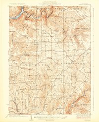
1924 Map of Tionesta
USGS Topo · Published 1924About this map
Allegheny National Forest dominates the northern reaches of this region, where the Allegheny River and Tionesta Creek carve deep through the plateau. This 1920s landscape is defined by its rural township structure, including Washington, Knox, and Elk, each dotted with namesake family crossroads and local educational centers. Notable industrial and transit markers include Helen Furnace in the southeast and the Shippenville Station along the Baltimore and Ohio line.
Find a feature on this map
104 named features on this map. Tap any name to fly to it.
Don’t see what you’re looking for? This feature index may not catch every label — zoom into the map to look around manually.
Map Details
Editions of this 1924 Tionesta Map
4 editions found
Other maps of this area

1906 · Clarion
USGS Topo · 1:62,500

1907 · Clarion
USGS Topo · 1:62,500

1907 · Foxburg
USGS Topo · 1:62,500

1908 · Foxburg
USGS Topo · 1:62,500

1918 · Loleta
USGS Topo · 1:62,500

1922 · Oil City
USGS Topo · 1:48,000

1922 · Tionesta
USGS Topo · 1:62,500

1924 · Oil City
USGS Topo · 1:62,500

1924 · Tionesta
USGS Topo · 1:62,500

1924 · Brookville
USGS Topo · 1:62,500