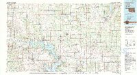
1985 Map of Tishomingo
USGS Topo · Published 1990About this map
Lake Texoma and the Washita River dominate this mid-1980s landscape, illustrating a region defined by extensive water management and federal conservation. The map highlights the vast Tishomingo National Wildlife Refuge and the Chickasaw Nat Recreation Area, underscoring the shift from purely agricultural land to recreational and protected spaces. Regional infrastructure is anchored by the Indian Nation Turnpike and long-standing rail lines like the Missouri-Kansas-Texas RR.
Find a feature on this map
111 named features on this map. Tap any name to fly to it.
Don’t see what you’re looking for? This feature index may not catch every label — zoom into the map to look around manually.
Map Details
Editions of this 1985 Tishomingo Map
3 editions found
Other maps of this area

1896 · Coalgate
USGS Topo · 1:125,000

1898 · McAlester
USGS Topo · 1:125,000

1898 · Pauls Valley
USGS Topo · 1:125,000

1899 · Coalgate
USGS Topo · 1:125,000

1899 · Atoka
USGS Topo · 1:125,000

1900 · Atoka
USGS Topo · 1:125,000

1900 · Coalgate
USGS Topo · 1:125,000

1901 · Stonewall
USGS Topo · 1:125,000

1901 · Tishomingo
USGS Topo · 1:125,000

1901 · Antlers
USGS Topo · 1:125,000