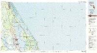
1979 Map of Titusville
USGS Topo · Published 1980About this map
The John F Kennedy Space Center (NASA) dominates this coastal landscape, illustrating the massive technological footprint of the space age within a complex environment of lagoons and marshes. In the late 1970s, the area shows a clear division between high-tech infrastructure, such as Launch Complex 39B and Cape Canaveral Air Force Station, and preserved natural areas like the Merritt Island National Wildlife Refuge. Along the western shore of the Indian River, established communities like Titusville and New Smyrna Beach are connected by the Florida East Coast railroad and highway corridors. Notable land grants, including those for Ambrose Hull and John H McIntosh, reveal the region's deeper property history beneath its modern identity. The mapping of the Canaveral National Seashore and numerous islands like Cedar Island highlights the transition from developed aerospace sites to untouched Atlantic coastline.
Find a feature on this map
110 named features on this map. Tap any name to fly to it.
Don’t see what you’re looking for? This feature index may not catch every label — zoom into the map to look around manually.
Map Details
Editions of this 1979 Titusville Map
This is the sole edition of this map. No revisions or reprints were ever made.
Other maps of this area

1937 · Port Orange
USGS Topo · 1:48,000

1943 · Port Orange
USGS Topo · 1:62,500

1944 · Port Orange
USGS Topo · 1:62,500

1949 · Oak Hill
USGS Topo · 1:24,000

1949 · Pardon Island
USGS Topo · 1:24,000

1949 · Orsino
USGS Topo · 1:24,000

1949 · False Cape
USGS Topo · 1:24,000

1949 · Titusville
USGS Topo · 1:24,000

1949 · Courtenay
USGS Topo · 1:24,000

1949 · Wilson
USGS Topo · 1:24,000