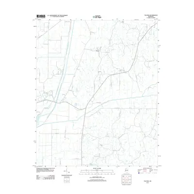
2012 Map of Tocowa
USGS Topo · Published 2012About this map
The Tocowa settlement and the wetlands of the Panola County floodplain are the focus of this 2012 survey. The landscape is defined by its complex drainage network, where the Little Tallahatchie River and the Yocona River converge within a web of historic watercourses like the Old Yocona River and Rayburn Bayou. The survey reveals a rural infrastructure of family-named roads and remote burial grounds, including Whitten Cem, Centerhill Cem, and Jackson Cem, which provide essential points of reference for local genealogy and land-use studies. The southeastern portion of the map is punctuated by smaller bodies of water such as Lake Martha and Buntyn Cr, reflecting the low-lying, hydrologically active nature of this Mississippi Delta region. This era of mapping documents the modern road grid, featuring routes like Muggie Hill Rd and Dummy Line Rd, which cut through the fertile bottomlands near the Shelton Cr drainage.
Find a feature on this map
56 named features on this map. Tap any name to fly to it.
Don’t see what you’re looking for? This feature index may not catch every label — zoom into the map to look around manually.
Map Details
Editions of this 2012 Tocowa Map
This is the sole edition of this map. No revisions or reprints were ever made.
Other maps of this area

1932 · Sledge
USGS Topo · 1:48,000

1935 · Crowder
USGS Topo · 1:62,500

1935 · Sledge
USGS Topo · 1:62,500

1939 · Sledge
USGS Topo · 1:62,500

1939 · Crowder
USGS Topo · 1:62,500

1948 · Helena
USGS Topo · 1:250,000

1950 · Helena
USGS Topo · 1:250,000

1952 · Sardis
USGS Topo · 1:62,500

1953 · Sardis
USGS Topo · 1:62,500

1954 · Oakland
USGS Topo · 1:62,500