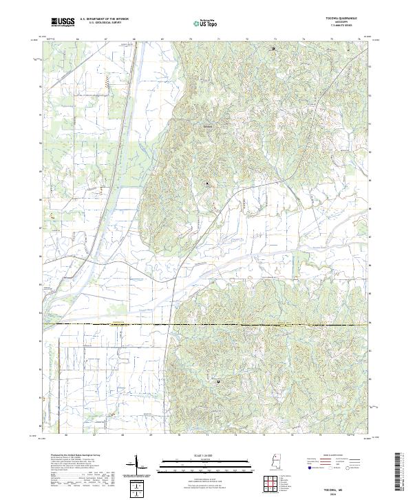
2024 Map of Tocowa
USGS Topo · Published 2024About this map
Tocowa lies at the heart of this landscape where the Little Tallahatchie River and the Yocona River converge near the boundary of Panola and Tallahatchie Counties. The map reveals a complex drainage system, including the Old Yocona River and several smaller tributaries such as Shelton Creek and Buntyn Creek. This 2024 survey documents the persistence of family-named landmarks and rural infrastructure, from Whitten Cem in the north to Jackson Cem and Center Hill Cem further south. The road network, featuring names like Yocona Gin Rd and Maggie Hill Rd, reflects the agricultural history of the region. The map provides a contemporary record of how these historical waterways and local roads continue to define the geography of northern Mississippi, capturing the intersection of the state's significant river systems within a predominantly rural setting.
Find a feature on this map
67 named features on this map. Tap any name to fly to it.
Don’t see what you’re looking for? This feature index may not catch every label — zoom into the map to look around manually.
Map Details
Editions of this 2024 Tocowa Map
This is the sole edition of this map. No revisions or reprints were ever made.
Other maps of this area

1932 · Sledge
USGS Topo · 1:48,000

1935 · Crowder
USGS Topo · 1:62,500

1935 · Sledge
USGS Topo · 1:62,500

1939 · Sledge
USGS Topo · 1:62,500

1939 · Crowder
USGS Topo · 1:62,500

1948 · Helena
USGS Topo · 1:250,000

1950 · Helena
USGS Topo · 1:250,000

1952 · Sardis
USGS Topo · 1:62,500

1953 · Sardis
USGS Topo · 1:62,500

1954 · Oakland
USGS Topo · 1:62,500