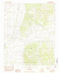
1982 Map of Tocowa
USGS Topo · Published 1983About this map
The Old Indian Treaty Boundary slices diagonally across this North Mississippi landscape, marking a historical division in Panola County and Tallahatchie County. The terrain is defined by the complex water systems of the Yocona River and its managed counterpart, the Quitman Floodway. Numerous bayous, including Meyers, Rayburn, and Fish Bayou, drain the lowlands west of the central hills where the small settlement of Tocowa is located.
Find a feature on this map
25 named features on this map. Tap any name to fly to it.
Don’t see what you’re looking for? This feature index may not catch every label — zoom into the map to look around manually.
Map Details
Editions of this 1982 Tocowa Map
This is the sole edition of this map. No revisions or reprints were ever made.
Other maps of this area

1932 · Sledge
USGS Topo · 1:48,000

1935 · Crowder
USGS Topo · 1:62,500

1935 · Sledge
USGS Topo · 1:62,500

1939 · Sledge
USGS Topo · 1:62,500

1939 · Crowder
USGS Topo · 1:62,500

1948 · Helena
USGS Topo · 1:250,000

1950 · Helena
USGS Topo · 1:250,000

1952 · Sardis
USGS Topo · 1:62,500

1953 · Sardis
USGS Topo · 1:62,500

1954 · Oakland
USGS Topo · 1:62,500