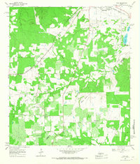
1964 Map of Togo
USGS Topo · Published 1968About this map
Small farming communities and scattered creek bottoms define the rural landscape of the Bastrop and Fayette county line during the mid-1960s. The settlement of Kovar serves as a local focal point, anchored by the Czech-Moravian Ch and the nearby Bartons Creek Ch, reflecting the area's cultural heritage. The terrain is marked by distinct rises like Pea Ridge and Royston Hill, which overlook a network of waterways including Gazley Creek and Pricklypear Creek. The presence of the Missouri Kansas Texas railroad corridor provides a clear industrial contrast to the surrounding timber and pastures. Significant gravel operations, indicated by various Gravel Pits, highlight the local extraction economy near the northern edge of the sheet. For genealogists, the inclusion of small, family-linked burial grounds such as the Thompson Cem and Old Bartons Creek Cem offers specific points of interest for tracing early residents.
Find a feature on this map
33 named features on this map. Tap any name to fly to it.
Don’t see what you’re looking for? This feature index may not catch every label — zoom into the map to look around manually.
Map Details
Editions of this 1964 Togo Map
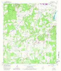
2 editions found
Other maps of this area

1885 · Bastrop
USGS Topo · 1:125,000

1893 · Bastrop
USGS Topo · 1:125,000

1901 · Flatonia
USGS Topo · 1:125,000

1904 · Bastrop
USGS Topo · 1:125,000

1948 · Smithville
USGS Topo · 1:62,500

1948 · Bastrop
USGS Topo · 1:62,500

1950 · Bastrop
USGS Topo · 1:62,500

1950 · Smithville
USGS Topo · 1:62,500

1953 · Seguin
USGS Topo · 1:250,000

1954 · Austin
USGS Topo · 1:250,000