
1956 Map of Toledo
USGS Topo · Published 1968About this map
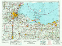
Lake Erie anchors this mid-century view of Northwest Ohio and Southeast Michigan, where the industrial hubs of Toledo and Lorain meet an intricate network of coastal marshes and islands. The post-war expansion of the region is evident in the newly completed Ohio Turnpike and a dense web of major rail lines including the New York Central RR and Pennsylvania RR. Military and conservation land uses occupy significant stretches of the shoreline, from the Erie Army Depot and Erie Proving Ground near Port Clinton to the protected wetlands of Ottawa NWR and the Magee Marsh State Game Preserve. Further out in the water, the Bass Islands — including South Bass Island and North Bass Island — are documented alongside the Canadian border, while inland settlements like Bowling Green, Findlay, and Tiffin serve as significant agricultural and transit nodes. This survey captures a moment when the heavy industrial infrastructure of the Great Lakes was at its peak before environmental conservation began to reshape the waterfront.
Find a feature on this map
276 named features on this map. Tap any name to fly to it.
Don’t see what you’re looking for? This feature index may not catch every label — zoom into the map to look around manually.
Map Details
Editions of this 1956 Toledo Map
4 editions found
Other maps of this area

1900 · Maumee Bay
USGS Topo · 1:62,500

1900 · Toledo
USGS Topo · 1:62,500

1900 · Oak Harbor
USGS Topo · 1:62,500

1901 · Oberlin
USGS Topo · 1:62,500

1901 · Put-In-Bay
USGS Topo · 1:62,500

1901 · Bellevue
USGS Topo · 1:62,500

1901 · Fostoria
USGS Topo · 1:62,500

1901 · Bowling Green
USGS Topo · 1:62,500

1901 · Fremont
USGS Topo · 1:62,500

1901 · Wooster
USGS Topo · 1:62,500