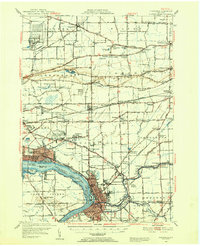
1948 Map of Tonawanda
USGS Topo · Published 1953About this map
North Tonawanda and its industrial neighbor across the Niagara River Tonawanda Channel, Tonawanda Island, anchor the southern end of this 1948 topographic study. The landscape is defined by the sharp drop of the Mountain Ridge, which separates the lowland settlements of Sanborn and Pekin from the agricultural plains to the north. This escarpment creates a dramatic transition between the plateau and the surrounding fruit-growing region, where numerous rural schoolhouses like School No 7 and School No 10 served scattered farmsteads before postwar consolidation.
Find a feature on this map
156 named features on this map. Tap any name to fly to it.
Don’t see what you’re looking for? This feature index may not catch every label — zoom into the map to look around manually.
Map Details
Editions of this 1948 Tonawanda Map
3 editions found
Other maps of this area

1894 · Buffalo
USGS Topo · 1:62,500

1894 · Niagara Falls
USGS Topo · 1:62,500

1894 · Wilson
USGS Topo · 1:62,500

1896 · Niagara Falls
USGS Topo · 1:62,500

1897 · Tonawanda
USGS Topo · 1:62,500

1897 · Olcott
USGS Topo · 1:62,500

1897 · Lockport
USGS Topo · 1:62,500

1899 · Niagara
USGS Topo · 1:125,000

1900 · Wilson
USGS Topo · 1:62,500

1900 · Tonawanda
USGS Topo · 1:62,500