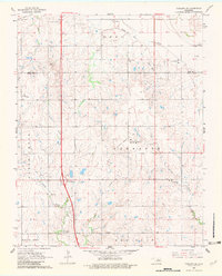
1968 Map of Tonkawa SE
USGS Topo · Published 1982About this map
The Three Sands Oil Field dominates the landscape of this Oklahoma survey, highlighting the intensive petroleum development within the Owen township area. Numerous Oil Wells, pumping stations, and a Gas Field are marked across the terrain, illustrating the region's industrial character during the late 1960s. Transportation infrastructure supports this production, including the C R I & P railroad line and the 4 Lane highway segment near the Okla 15 Interchange.
Find a feature on this map
27 named features on this map. Tap any name to fly to it.
Don’t see what you’re looking for? This feature index may not catch every label — zoom into the map to look around manually.
Map Details
Editions of this 1968 Tonkawa SE Map
2 editions found
Other maps of this area

1955 · Enid
USGS Topo · 1:250,000

1958 · Enid
USGS Topo · 1:250,000

1968 · Billings
USGS Topo · 1:24,000

1968 · Tonkawa SE
USGS Topo · 1:24,000

1968 · Marland
USGS Topo · 1:24,000

1968 · Ponca City NW
USGS Topo · 1:24,000

1968 · Eddy
USGS Topo · 1:24,000

1968 · Tonkawa
USGS Topo · 1:24,000

1972 · Perry NW
USGS Topo · 1:24,000

1972 · Red Rock
USGS Topo · 1:24,000