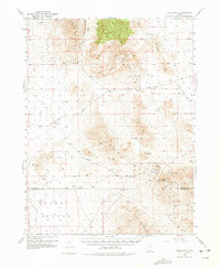
1953 Map of Topaz Mtn
USGS Topo · Published 1975About this map
Spor Mountain and the Thomas Range anchor this high-desert landscape during the mid-century, a period when mineral exploration defined the Great Basin. The map details a network of mining activities and essential water sources, such as the Bell Hill Mine and the remote Black Boy Mine. The presence of the Joy (Site) and various Prospects throughout the Drum Mountains reflects the prospecting history of the region. Transportation is marked by the Sand Pass Road and a primitive Trail system that connects these distant peaks. Water, always critical in this arid terrain, is localized at Schoenburger Spring and Laird Spring, providing vital points for early travelers and miners navigating between Topaz Mountain and the Swasey Mountains.
Find a feature on this map
39 named features on this map. Tap any name to fly to it.
Don’t see what you’re looking for? This feature index may not catch every label — zoom into the map to look around manually.
Map Details
Editions of this 1953 Topaz Mtn Map
4 editions found
Other maps of this area

1885 · Sevier Desert
USGS Topo · 1:250,000

1908 · Fish Springs
USGS Topo · 1:250,000

1910 · Fish Springs
USGS Topo · 1:250,000

1953 · Dugway Pass
USGS Topo · 1:24,000

1953 · Dugway Range
USGS Topo · 1:62,500

1953 · Topaz Mtn
USGS Topo · 1:62,500

1953 · Delta
USGS Topo · 1:250,000

1958 · Delta
USGS Topo · 1:250,000

1962 · Delta
USGS Topo · 1:250,000

1967 · Sand Pass SE
USGS Topo · 1:24,000