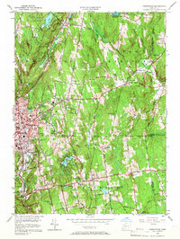
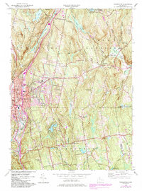
1956 Map of Torrington
USGS Topo · Published 1967About this map
Torrington stands as a bustling industrial and residential center along the Naugatuck River in the mid-1950s, its urban grid contrasting with the surrounding Litchfield County hills. The transit network is dominated by the New York New Haven and Hartford railroad, which follows the river valley through East Litchfield and north toward Burrville. Beyond the city limits, the landscape transitions into a mix of dense woodlands like Paugnut State Forest and emerging suburban developments, evidenced by the Drive-in Theater and clusters of new streets near Torringford Ch.
Find a feature on this map
85 named features on this map. Tap any name to fly to it.
Don’t see what you’re looking for? This feature index may not catch every label — zoom into the map to look around manually.
Map Details
Editions of this 1956 Torrington Map
5 editions found
Other maps of this area

1892 · Winsted
USGS Topo · 1:62,500

1892 · Meriden
USGS Topo · 1:62,500

1892 · Granby
USGS Topo · 1:62,500

1893 · Waterbury
USGS Topo · 1:62,500

1893 · Meriden
USGS Topo · 1:62,500

1904 · Waterbury
USGS Topo · 1:62,500

1904 · Litchfield
USGS Topo · 1:125,000

1906 · Farmington
USGS Topo · 1:125,000

1946 · Bristol
USGS Topo · 1:31,680

1947 · Hartford
USGS Topo · 1:250,000