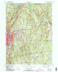
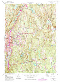
1956 Map of Torrington
USGS Topo · Published 1984About this map
The industrial hub of Torrington anchors this mid-century landscape, where the Naugatuck River and Still River converge amid a complex of urban and rural features. The 1956 data, updated with 1980s photographic revisions, shows a city in transition, featuring the Armory, several localized schools like North Sch, and the expansion of the Sewage Disposal system. To the east and south, the terrain rises into the Litchfield hills, revealing a network of smaller communities including Bakersville, Maple Hollow, and Harwinton.
Find a feature on this map
63 named features on this map. Tap any name to fly to it.
Don’t see what you’re looking for? This feature index may not catch every label — zoom into the map to look around manually.
Map Details
Editions of this 1956 Torrington Map
5 editions found
Other maps of this area

1892 · Winsted
USGS Topo · 1:62,500

1892 · Meriden
USGS Topo · 1:62,500

1892 · Granby
USGS Topo · 1:62,500

1893 · Waterbury
USGS Topo · 1:62,500

1893 · Meriden
USGS Topo · 1:62,500

1904 · Waterbury
USGS Topo · 1:62,500

1904 · Litchfield
USGS Topo · 1:125,000

1906 · Farmington
USGS Topo · 1:125,000

1946 · Bristol
USGS Topo · 1:31,680

1947 · Hartford
USGS Topo · 1:250,000