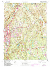
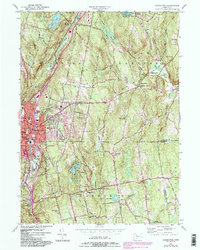
1956 Map of Torrington
USGS Topo · Published 1984About this map
The industrial and residential growth of Torrington anchors this 1956 mid-century update, revealing a landscape where urban expansion meets the wooded hills of Paugnut State Forest. Along the western edge, the city's infrastructure is visible through landmarks like the Armory and local education centers including Wolcott Sch and North Sch. To the east, the rural character remains more prominent in the small settlements of Bakersville and Maple Hollow, while the historical religious life of the community is marked by the Torringford Ch and several burial grounds like St Francis Cem. Water resources define the local geography, from the Still River and Naugatuck River to recreational and utility bodies such as Lake Harwinton and Burr Pond. This edition, updated with 1982 aerial data, shows the evolution of the road network with State Hwy 4 and State Hwy 183 connecting these upland communities.
Find a feature on this map
55 named features on this map. Tap any name to fly to it.
Don’t see what you’re looking for? This feature index may not catch every label — zoom into the map to look around manually.
Map Details
Editions of this 1956 Torrington Map
5 editions found
Other maps of this area

1892 · Winsted
USGS Topo · 1:62,500

1892 · Meriden
USGS Topo · 1:62,500

1892 · Granby
USGS Topo · 1:62,500

1893 · Waterbury
USGS Topo · 1:62,500

1893 · Meriden
USGS Topo · 1:62,500

1904 · Waterbury
USGS Topo · 1:62,500

1904 · Litchfield
USGS Topo · 1:125,000

1906 · Farmington
USGS Topo · 1:125,000

1946 · Bristol
USGS Topo · 1:31,680

1947 · Hartford
USGS Topo · 1:250,000