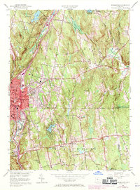
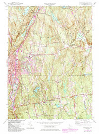
1956 Map of Torrington
USGS Topo · Published 1970About this map
Industrial development and rural Litchfield County landscapes meet in this mid-century survey of the Torrington area. The urban core of the city is detailed with landmarks like the Armory and various local schools including Wolcott Sch and South Sch. Extending outward from the Naugatuck River valley, the map reveals a terrain of prominent peaks such as Burr Mtn and Cotton Hill, punctuated by numerous reservoirs and recreational spaces like Paugnut State Forest and Camp Pioneer.
Find a feature on this map
40 named features on this map. Tap any name to fly to it.
Don’t see what you’re looking for? This feature index may not catch every label — zoom into the map to look around manually.
Map Details
Editions of this 1956 Torrington Map
5 editions found
Other maps of this area

1892 · Winsted
USGS Topo · 1:62,500

1892 · Meriden
USGS Topo · 1:62,500

1892 · Granby
USGS Topo · 1:62,500

1893 · Waterbury
USGS Topo · 1:62,500

1893 · Meriden
USGS Topo · 1:62,500

1904 · Waterbury
USGS Topo · 1:62,500

1904 · Litchfield
USGS Topo · 1:125,000

1906 · Farmington
USGS Topo · 1:125,000

1946 · Bristol
USGS Topo · 1:31,680

1947 · Hartford
USGS Topo · 1:250,000