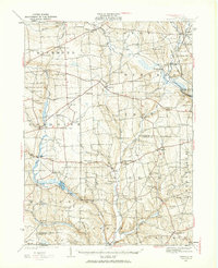
1927 Map of Townville
USGS Topo · Published 1964About this map
The agrarian and creek-fed landscape of Crawford and Venango Counties appears here in high detail, surveyed in the late 1920s. The region is defined by a dense network of township roads connecting numerous small settlements like Townville and Guys Mills. Local education and community life are prominently represented through an exhaustive mapping of rural schoolhouses, including the Lamb Sch, Steuben Sch, and Hickory Cors Sch, which anchored these crossroads communities before the era of school consolidation.
Find a feature on this map
98 named features on this map. Tap any name to fly to it.
Don’t see what you’re looking for? This feature index may not catch every label — zoom into the map to look around manually.
Map Details
Editions of this 1927 Townville Map
3 editions found

Other maps of this area

1909 · Franklin
USGS Topo · 1:62,500

1911 · Franklin
USGS Topo · 1:62,500

1911 · Stoneboro
USGS Topo · 1:62,500

1913 · Stoneboro
USGS Topo · 1:62,500

1922 · Oil City
USGS Topo · 1:48,000

1923 · Meadville
USGS Topo · 1:62,500

1923 · Cambridge Springs
USGS Topo · 1:62,500

1924 · Oil City
USGS Topo · 1:62,500

1925 · Meadville
USGS Topo · 1:62,500

1925 · Cambridge Springs
USGS Topo · 1:62,500