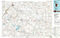
1986 Map of Tracy
USGS Topo · Published 1991About this map
Lake Shetek and Lake Sarah anchor the southern reach of this prairie landscape, where the headwaters of the Des Moines River and Cottonwood River begin their descent across the Minnesota plains. The drainage patterns are defined by numerous glacial depressions, including the notable Great Oasis Lakebed and Bigel Lakebed, which have been historically significant for regional agriculture. A dense network of state wildlife management areas, such as the Prairie Marshes State Wildlife Management Area, reflects a commitment to preserving the original wetland character of the region amidst the agricultural grid.
Find a feature on this map
151 named features on this map. Tap any name to fly to it.
Don’t see what you’re looking for? This feature index may not catch every label — zoom into the map to look around manually.
Map Details
Editions of this 1986 Tracy Map
2 editions found
Other maps of this area

1952 · Morton
USGS Topo · 1:62,500

1952 · Redwood Falls
USGS Topo · 1:62,500

1953 · Morgan
USGS Topo · 1:62,500

1953 · Watertown
USGS Topo · 1:250,000

1953 · New Ulm
USGS Topo · 1:250,000

1954 · Fairmont
USGS Topo · 1:250,000

1955 · Sioux Falls
USGS Topo · 1:250,000

1957 · New Ulm
USGS Topo · 1:250,000

1958 · New Ulm
USGS Topo · 1:250,000

1958 · Sioux Falls
USGS Topo · 1:250,000