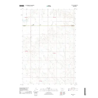
2017 Map of Trail City
USGS Topo · Published 2017About this map
Trail City sits at the northern edge of the Dewey County line, a community defined by its proximity to the wide-open prairies of north-central South Dakota. The presence of the Trail City Cem and the local Po indicate its status as a central hub for the surrounding ranching and agricultural operations. The landscape is deeply dissected by a network of drainage ways including Snake Cr, Handboy Cr, and Du Charme Cr, which flow through the rolling terrain toward the Missouri River basin. A significant landmark for both geography and history is Trail City Railroad Lake, located northwest of the town center. This feature, along with the grid-like progression of rural routes such as Lake Rd and Twp Rd, illustrates the intersection of early 20th-century transportation infrastructure with the natural hydrology of the plains.
Find a feature on this map
19 named features on this map. Tap any name to fly to it.
Don’t see what you’re looking for? This feature index may not catch every label — zoom into the map to look around manually.
Map Details
Editions of this 2017 Trail City Map
This is the sole edition of this map. No revisions or reprints were ever made.
Other maps of this area

1951 · Promise
USGS Topo · 1:24,000

1952 · Trail City SW
USGS Topo · 1:24,000

1952 · Glencross SE
USGS Topo · 1:24,000

1953 · McIntosh
USGS Topo · 1:250,000

1956 · Wakpala SE
USGS Topo · 1:24,000

1956 · Little Eagle SE
USGS Topo · 1:24,000

1956 · Wakpala SW
USGS Topo · 1:24,000

1958 · McIntosh
USGS Topo · 1:250,000

1975 · Laundreaux Butte
USGS Topo · 1:24,000

1975 · Trail City
USGS Topo · 1:24,000