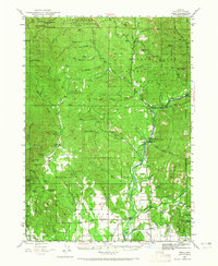
1943 Map of Trail
USGS Topo · Published 1965About this map
Rogue River dominates the central landscape of this 1943 survey, carving a path through Jackson County's timber and ranch lands. The settlement at Shady Cove serves as a focal point along the river, while the lower valleys show established agricultural operations at Younkers Ranch, Drake Ranch, and Cliff Ranch. This era reflects a high-activity period for the regional timber industry, evidenced by the Logging Railroad winding through the eastern hills and several lookout points like those on Willy Mtn and Buck Rock.
Find a feature on this map
80 named features on this map. Tap any name to fly to it.
Don’t see what you’re looking for? This feature index may not catch every label — zoom into the map to look around manually.
Map Details
Editions of this 1943 Trail Map
4 editions found
Other maps of this area

1891 · Ashland
USGS Topo · 1:250,000

1893 · Ashland
USGS Topo · 1:250,000

1897 · Ashland
USGS Topo · 1:250,000

1904 · Riddle
USGS Topo · 1:125,000

1908 · Grants Pass
USGS Topo · 1:125,000

1938 · Medford
USGS Topo · 1:125,000

1943 · Trail
USGS Topo · 1:62,500

1944 · Tiller
USGS Topo · 1:62,500

1944 · Abbott Butte
USGS Topo · 1:62,500

1947 · Abbott Butte
USGS Topo · 1:62,500