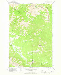
1970 Map of Trap Mountain
USGS Topo · Published 1973About this map
The Continental Divide winds through this high-altitude landscape on the border of Lewis and Clark and Powell Counties. Documented in the early 1970s, the terrain is defined by the convergence of the Bob Marshall Wilderness and the Sun River Game Preserve. The absence of established land lines reflects the remote character of this protected backcountry, where human presence is marked only by isolated outposts like the Basin Creek Guard Station and a network of named routes including the Jumbo Lookout Trail.
Find a feature on this map
37 named features on this map. Tap any name to fly to it.
Don’t see what you’re looking for? This feature index may not catch every label — zoom into the map to look around manually.
Map Details
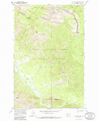
Editions of this 1970 Trap Mountain Map
2 editions found
Other maps of this area

1902 · Ovando
USGS Topo · 1:125,000

1903 · Saypo
USGS Topo · 1:125,000

1903 · Coopers Lake
USGS Topo · 1:125,000

1905 · Ovando
USGS Topo · 1:125,000

1936 · Silvertip
USGS Topo · 1:96,000

1942 · Silvertip
USGS Topo · 1:125,000

1955 · Choteau
USGS Topo · 1:250,000

1957 · Choteau
USGS Topo · 1:250,000

1958 · Choteau
USGS Topo · 1:250,000

1958 · Pretty Prairie
USGS Topo · 1:24,000