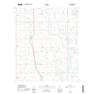
2020 Map of Trenton
USGS Topo · Published 2020About this map
Trenton and the neighboring settlement of Catuna anchor this portion of DeSoto Parish, where a dense network of local roads such as Hudson Darby Rd and Trenton Rd connect established rural communities. The landscape is defined by its numerous family and community burial grounds, including Stephenson Cem, Flanagan Cem, and the Shiloh Church Cem, indicating deep generational ties to the land. Drainage for the region is provided by a complex system of bayous and creeks, most notably Bayou San Patricio and Green Cane Bayou. The proximity of Oxford in the east and the presence of smaller landmarks like Lee Cem suggest a long-standing pattern of dispersed agricultural homesteads. The terrain is further characterized by local waterways such as Duke Bayou and the unusually named Stinkfinger Cr near the southern boundary.
Find a feature on this map
62 named features on this map. Tap any name to fly to it.
Don’t see what you’re looking for? This feature index may not catch every label — zoom into the map to look around manually.
Map Details
Editions of this 2020 Trenton Map
This is the sole edition of this map. No revisions or reprints were ever made.
Other maps of this area

1941 · Pelican
USGS Topo · 1:62,500

1943 · Pleasant Hill
USGS Topo · 1:62,500

1944 · Logansport
USGS Topo · 1:62,500

1944 · Pleasant Hill
USGS Topo · 1:62,500

1945 · Grand Cane
USGS Topo · 1:62,500

1945 · Mansfield
USGS Topo · 1:62,500

1947 · Mansfield
USGS Topo · 1:62,500

1953 · Alexandria
USGS Topo · 1:250,000

1955 · Shreveport
USGS Topo · 1:250,000

1955 · Alexandria
USGS Topo · 1:250,000