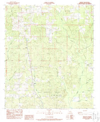
1989 Map of Trenton
USGS Topo · Published 1989About this map
The Las Ormigas Grant dominates the southern landscape of this De Soto Parish survey, showcasing the enduring influence of early land grants on Louisiana's geography. Small settlements including Trenton, Catuna, and Oxford are dispersed across a terrain defined by complex watercourses such as San Patricio Bayou and Green Cane Bayou. The presence of an Old Railroad Grade and a Gravel Pit suggests the industrial history of the region, while numerous oil and gas wells indicate the local energy economy. To the north, Clemar Creek and Cow Bayou cut through the timbered hills, and a local Cem offers a point of interest for genealogists tracing family roots in this rural corridor near the Sabine River basin.
Find a feature on this map
21 named features on this map. Tap any name to fly to it.
Don’t see what you’re looking for? This feature index may not catch every label — zoom into the map to look around manually.
Map Details
Editions of this 1989 Trenton Map
This is the sole edition of this map. No revisions or reprints were ever made.
Other maps of this area

1941 · Pelican
USGS Topo · 1:62,500

1943 · Pleasant Hill
USGS Topo · 1:62,500

1944 · Logansport
USGS Topo · 1:62,500

1944 · Pleasant Hill
USGS Topo · 1:62,500

1945 · Grand Cane
USGS Topo · 1:62,500

1945 · Mansfield
USGS Topo · 1:62,500

1947 · Mansfield
USGS Topo · 1:62,500

1953 · Alexandria
USGS Topo · 1:250,000

1955 · Shreveport
USGS Topo · 1:250,000

1955 · Alexandria
USGS Topo · 1:250,000