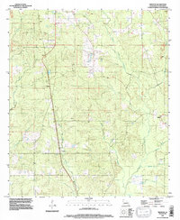
1995 Map of Trenton
USGS Topo · Published 1997About this map
Trenton and Catuna sit within a heavily wooded landscape of De Soto Parish, defined by the winding drainage networks of Bayou San Patricio and its many tributaries. This mid-1990s survey illustrates a region where small rural settlements like Oxford and Marlene are connected by a web of local roads and pipelines, reflecting the area's timber and resource-based economy. The presence of numerous unnamed cemeteries and small homesteads like Adams and Gleason provides a valuable record for genealogists researching family landholdings in northwest Louisiana.
Find a feature on this map
23 named features on this map. Tap any name to fly to it.
Don’t see what you’re looking for? This feature index may not catch every label — zoom into the map to look around manually.
Map Details
Editions of this 1995 Trenton Map
This is the sole edition of this map. No revisions or reprints were ever made.
Other maps of this area

1941 · Pelican
USGS Topo · 1:62,500

1943 · Pleasant Hill
USGS Topo · 1:62,500

1944 · Logansport
USGS Topo · 1:62,500

1944 · Pleasant Hill
USGS Topo · 1:62,500

1945 · Grand Cane
USGS Topo · 1:62,500

1945 · Mansfield
USGS Topo · 1:62,500

1947 · Mansfield
USGS Topo · 1:62,500

1953 · Alexandria
USGS Topo · 1:250,000

1955 · Shreveport
USGS Topo · 1:250,000

1955 · Alexandria
USGS Topo · 1:250,000